Devastating Flash Flood and Mudslide Strike Remote Nepal-Tibet Border Zone
Constantvpn.com – A catastrophic combination of flash flooding and a massive mudslide tore through the high-altitude corridor along the Nepal-Tibet border, killing at least 31 people and leaving hundreds of tourists unaccounted for. The disaster struck with little to no warning, sweeping away trails, camps, and groups of trekkers in one of the most geographically isolated stretches of the Himalayan range. Footage captured at the moment of impact has since circulated widely, offering a harrowing glimpse of how quickly a mountain valley can transform from a quiet passage into a churning torrent of water and debris.
The Moment of Impact
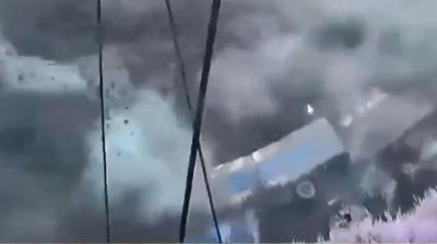
Video recorded at the scene shows the flood wall arriving with almost no advance notice. Within seconds, a torrent of muddy water and displaced earth engulfed the narrow valley floor where groups of visitors had been traveling. The force of the event was total: structures, vegetation, and the ground itself were ripped away in a single, continuous surge. Because the terrain in this border region consists of steep, unstable slopes carved by millennia of glacial and seismic activity, even a short burst of intense rainfall can trigger a cascade failure that sends thousands of tonnes of saturated soil and rock tumbling downhill within minutes.
The footage, which has been edited to include brief white flashes at points of particularly graphic impact, was prepared to give viewers a moment’s visual respite before the most disturbing frames. That editorial choice underscores how raw and unsettling the original recording is — a reminder that what appears on screen is a fraction of what witnesses experienced in real time.
Why Rescue Is Extraordinarily Difficult
The Nepal-Tibet border sits at elevations well above 4,000 metres, in a region where paved roads are sparse and weather windows close rapidly. Once a flood or slide buries a trail, the primary means of reaching stranded travelers vanishes. Helicopter operations, which would normally be the fastest option, are constrained by altitude, thin air, and the very cloud cover and wind shear that accompany the storms producing such disasters. Ground teams must often approach on foot over days of difficult terrain, carrying limited supplies and working in conditions where hypothermia and altitude sickness threaten rescuers as much as the injured.
The scale of the missing-person toll — hundreds of tourists — compounds the logistical burden. Each individual requires locating, assessment, extraction, and medical stabilization, all performed in an environment where communication infrastructure is minimal and the nearest major medical facility may be a full day’s travel away. Local authorities on both sides of the border have mobilized search-and-rescue units, but the sheer remoteness of the affected corridor means that full accounting of casualties could take many days, and in some cases weeks.
A Region Already Under Pressure
The Himalayan border zone between Nepal and Tibet’s Ngari Prefecture has long been recognized as a high-risk corridor for natural hazards. The area sits atop active fault lines, and successive earthquakes over recent decades have fractured bedrock, leaving slopes primed for failure. Monsoon-season rainfall, which peaks between June and September, delivers intense downpours that saturate these weakened slopes almost instantly. Climate trends have intensified both the frequency and severity of extreme precipitation events in the region, shortening the window between the first heavy rain and a full-scale slope collapse.
Tourism in the high Himalaya has grown steadily over the past two decades, drawing trekkers, photographers, and expedition groups into valleys and passes that were once traversed only by local herders and trade caravans. That growth brings economic benefit to small border communities, but it also concentrates human life in precisely the corridors most vulnerable to flash floods and debris flows. Trail infrastructure, warning signage, and emergency communication networks have not kept pace with the rising number of visitors, leaving groups exposed when conditions turn.
What the Footage Tells Us
The recorded sequence of events carries practical lessons for anyone planning high-altitude travel in monsoon-season Himalaya. The flood arrived with essentially no lead time — no prolonged rumble, no visible upstream swelling that would have allowed a group to climb to higher ground. In narrow V-shaped valleys, where escape routes are limited to the valley walls, even a moderate surge can trap people within seconds. The footage reinforces what mountain-safety experts have long emphasized: in confined terrain, the margin between a manageable stream and a lethal wall of water can be measured in minutes, and sometimes less.
For the families of those still missing, the coming days will be defined by a painful uncertainty. Search operations continue on both sides of the border, coordinated through bilateral channels that have been tested by previous disasters in the region. Until every trail segment has been cleared and every campsite inspected, the final toll will remain unknown. What is already certain is that at least 31 lives were lost in a single, violent event — a reminder that in the high mountains, the landscape does not negotiate, and the cost of underestimating a storm can be paid in full within the span of a single afternoon.
Related Reading
Frequently Asked Questions
What is shows scale of flash flood hitting?
shows scale of flash flood hitting is the main topic of this guide. The article explains the context, practical details, and next steps readers should understand.
Why does shows scale of flash flood hitting matter?
shows scale of flash flood hitting matters because readers are looking for a useful answer, not just a short summary. Good content should match search intent and help them decide what to do next.